
Outsource Geospatial Services
Accelerate project delivery with our scalable geospatial, mapping, and survey assistance tailored to your industry, converting raw data into spatial intelligence.
Get accurate location intelligence to plan and maintain modern infrastructure assets with our comprehensive geospatial services. We deliver customized geospatial data services that help you manage GIS information from sources like remote sensing and topographic surveys, across diverse sectors from energy and utilities to transportation and infrastructure.
Our geospatial and GIS surveying services convert raw datasets into 2D/3D geodatabases, which help you increase asset visibility, support connectivity analysis, and improve infrastructure planning. We process LiDAR, GPR, photogrammetry, CAD, and UVA datasets to create precision-aligned planimetric, topographic, and utility maps.
Our team has experienced and young professionals who collaborate to address the unique challenges of complex GIS survey requirements. We assemble multi-disciplinary teams for complex projects, and our ISO-certified workflows ensure topology validation, metadata compliance, and projection integrity.
Eliminate processing backlogs and maintain high positional accuracy across all map layers with our geospatial services company.
Our Geospatial and GIS Surveying Solutions
-
Surveys Based on Planimetric Mapping

- Deliver 2D horizontal features from GPS and total-station survey datasets.
- Map detailed terrains, drainage lines, and man-made features with accuracy.
- Provide GIS-ready planimetric layers for asset and infrastructure management.
-
Electrical Infrastructure Surveys

- Capture underground electrical distribution using GIS-enabled field data collection.
- Map and distinguish commercial, domestic, and industrial power line corridors with precision.
- Use GIS-based analysis to map electrical assets and identify connectivity gaps in power grids.
-
Photogrammetric Mapping Services

- Generate detailed contour maps and high-accuracy DEM/DSM surfaces.
- Derive hydrological features to perform slope and watershed analysis.
- Deliver orthorectified imagery for easy integration into enterprise your GIS databases.
-
Property and Underground Utility Mapping

- Evaluate data from GPR and electromagnetic surveys to identify subsurface utilities.
- Georeference all the underground cables, conduits, and pipelines within your GIS frameworks.
- Map utility data with property boundaries for accurate infrastructure planning and asset management.
-
Topographic and Ground Surveying

- Provide terrain details and 2D planimetric layers using LiDAR, photogrammetric, and GPS datasets.
- Create DSM, DEM, and contour maps for slope and hydrological assessments.
- Analyze ground and elevation data for dams, tunnels, roads, and civil infrastructure planning.
-
Utility and Infrastructure GIS Mapping

- Create 3D corridor alignment models and spatial reports from LiDAR/UAV data.
- Manage GIS databases for telecom networks, gas pipelines, and power distribution systems.
- Map multi-source geospatial data for conceptualizing and designing fiber optic cable layouts.
-
Cellular and Radiation Impact Mapping

- Assess compliance with national safety standards using GIS-based population overlays.
- Model and visualize antenna radiation dispersions using GIS-based population density overlays.
- Integrate radiation intensity data into urban and environmental planning layers.
-
Base Map and GIS Data Development

- Generate base maps using satellite imagery, orthorectification, and georeferenced data.
- Digitize, vectorize, and standardize legacy maps for integration into enterprise GIS systems.
- Align CAD drawings to geospatial coordinate systems with defined attributes and topologies.
-
GIS for Urban and Demographic Planning

- Create multi-layer geospatial datasets for land use, socio-environmental modeling, and zoning.
- Integrate consumer, demographic, and transportation data to simulate urban developments.
- Support sustainable city planning and infrastructure design with data-driven GIS analytics.
-
AI/ML-Ready GIS Data Services
- Label drone and satellite images to automate object detection and train ML models.
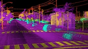
- Apply geospatial references and annotate LiDAR point clouds for AI-driven spatial interpretation.
- Deliver cloud-integrated, fully annotated, and GDPR-compliant datasets for AI workflows.
Additional Services You Can Benefit From



Why Should You Choose Our Geospatial Services Company
We are a top geographic information system service providing company and have helped numerous clients spread across the world with their GIS needs. Outsourcing geographic information system services to BIM Engineering offers the following advantages –
-
All-Inclusive Geospatial Data Management
Whether you want data validation or mapping assistance for visualizing and analyzing spatial information, we team will deliver accurately processed and standardized GIS data sets.
-
Advanced Geospatial Analytics Services
Using machine learning, spatial statistics, and AI, we help you predict future patterns and identify hidden trends, which is crucial to improve asset performance for high-stakes projects.
-
Expertise in Multi-Platform GIS Data Integration
We have the expertise and tool proficiency to integrate processed GIS data with your enterprise systems, such as ERP, CRM, CAD, and BIM. This supports real-time reporting and easy data exchange.
-
Accurate Mapping of Remote Sensing and LiDAR Datasets
With satellite imagery, UAVs, and photogrammetry, we provide detailed mapping, which is essential for utilities, transportation, and environmental planning projects.
-
Cloud-Based GIS Data Processing Solutions
Our cloud-native GIS data processing frameworks are ideal for storing, processing, and integrating high volumes of your geospatial data, as they ensure security and flexibility.
-
Complete Data Security and Compliance
We adhere to global data privacy standards and geospatial data regulations. Our team uses encryption, implements access controls, and conducts frequent audits to protect your sensitive spatial information.
Customer Success Stories
Radius Map Creation Using CAD
An expediting and consulting firm from the USA approached BIM Engineering to create high-quality CAD-based radius maps which were then delivered at 1005 accuracy.
Read moreBIM Engineering Provided As-Built Drawings to US Architectural Firm
A US architectural firm needed us to build CAD models complete with electrical layouts, switch positions, RCP, etc. We performed work for 230 sites within 2 months using 11 members.
Read moreTestimonials
Spokesperson, Oil Exploration Company in the USWe are very satisfied with BIM Engineering's services. They have met all our deadlines and exceeded our expectations in quality. We consider them a valuable part of our team.