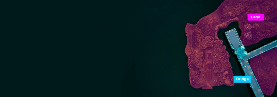
GIS Labeling and Annotation Services
Build smarter geospatial systems that drive intelligent planning with our accurate, structured, and AI-ready GIS labeling and annotation services
Insights on location-based strategic planning begin with precise geospatial information. But if raw imagery and point clouds are scattered or inconsistent, even the most sophisticated GIS systems fail. This is where our proficient GIS labeling and annotation services bring precision and clarity. Our specialists use a combination of tools, such as QGIS, AutoCAD, and LiDAR processing software, and techniques, like semantic segmentation and vectorization, to convert spatial information into AI-ready, structured formats.
We use cloud-based GIS annotation platforms to securely process large GIS datasets and facilitate seamless team collaboration. Automated GIS data validation workflows are used to increase accuracy and consistency in every step. The result? Your geospatial data is not just labeled, but duly structured, georeferenced, and enhanced with semantic information to drive infrastructure analytics, smart city initiatives, and AI/ML training.
Leverage our GIS labeling and annotation services for robust spatial organization, attribute consistency, and detailed topology relationships that are specific to your projects.
GIS Labeling and Annotation Solutions We Offer
Our geospatial data annotation services are built on precision and scalability. With a focus on consistency and interoperability across diverse GIS data formats, we offer custom geographic information system services that transform complex spatial datasets into structured assets that power advanced geospatial analysis.
-
Semantic Segmentation and Object Identification
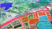
- Pixel-level labeling to accurately classify land use, terrains, natural features, and buildings.
- AI-based semantic segmentation for detecting agricultural, environmental, and urban regions.
- Identification and classification of buildings, vegetation, water bodies, and roads in imagery data collections.
-
Polygon and Polyline Annotation

- Create polygon and polyline boundaries for infrastructure, structural, and land plot boundaries.
- Label rivers, pipelines, roads, and other linear elements for GIS mapping and analysis.
- Generate vector-based AI-ready geospatial datasets that are compatible with different types of mapping apps.
-
Change Detection and Temporal Annotation
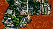
- Satellite imagery labeling services to interpret multi-temporal imagery for tracking urban expansion, deforestation, and land use.
- GIS labeling and annotation services tailored to identify environmental, seasonal, and terrain changes over time.
- GIS image labeling for infrastructure analytics and past datasets annotation support geospatial trend analysis and predictive modeling.
-
Point Cloud and LiDAR Data Processing
- Label LiDAR point clouds for vegetation, buildings, terrain, utilities, and other 3D features.
- Point cloud annotation for GIS to extract structural and topographic features to support navigation and infrastructure projects.
- LiDAR annotation and labeling to create AI-ready geospatial datasets for digital twins and predictive geospatial modeling.
-
Geospatial Video Annotation

- Annotation of surveillance and drone videos for people, environmental changes, and dynamic objects.
- Frame-by-frame annotation that supports accurate AI object tracking and detection.
- Creating structured, AI-ready video datasets for smart city, defense, and research purposes.
-
Map Feature Labeling and Digitization

- Overlay semantic labels, attributes, and metadata on roads, map layers, and waterways.
- GIS labeling and annotation services to convert raw or analog map data into fully digitized, AI-compatible GIS formats.
- Ensure topological correctness, semantic density, and feature consistency on GIS databases.
-
AI/ML Dataset Preparation for Geospatial Models

- Curate labeled spatial datasets optimized for predictive analytics and AI/ML model training.
- LiDAR annotation and labeling to prepare multi-source imagery for autonomous navigation and land monitoring.
- Ensure high data quality, semantic consistency, and AI-readiness for geospatial applications.
-
3D Mapping and Visualization Support

- Annotate digital twin datasets and 3D reconstruction datasets for immersive GIS.
- Add semantic labels for infrastructure and environmental features within 3D models.
- Create 3D digital models of geographic areas to facilitate review and analysis of specific regions.
Additional Services You Can Benefit From




Why Should You Choose Our GIS Labeling and Annotation Company?
Assisting global clients in driving GIS annotation and labeling projects, we turn raw spatial data into actionable intelligence. Our team brings technical expertise and strategic vision. This, coupled with our scalable workflows, enables you to maximize the value of your datasets.
-
Expert Annotation Teams
Geospatial knowledge of our labeling experts and advanced AI-driven processes deliver precise polygon/polyline annotation, semantic segmentation, and feature extraction on LiDAR, satellite, and drone data.
-
Global Outsourcing Advantage and Easy Scalability
Distributed teams ensure 24/7 project execution and high-volume dataset processing at shorter turnarounds. This enables you to scale your GIS labeling projects without compromising quality or continuity.
-
Customizable Workflows and Client-Specific Standards
GIS annotation workflows are tailored to your GIS standards, formats, and labeling conventions to save time and maintain data consistency in projects and integrations, involving AI pipelines or analytics.
-
Consultative Support and Strategic Data Insights
We offer actionable insights from annotated spatial datasets to help you prioritize features, improve model performance, and extract geospatial intelligence for long-term planning purposes.
-
Cloud-Integrated Workflows for Higher Volumes
Secure cloud-based pipelines with automated validation and workflow monitoring features ensure collaborative and scalable GIS data processing. This increases data integrity and accelerates delivery timelines.
-
Quality Assurance and Compliance
Annotated and labeled datasets are automatically and manually validated for topological consistency and semantic correctness. GDPR-compliant workflows and strict QA ensure global compliance.
Client Success Stories

Radius Map Creation Using CAD
An expediting and consulting firm from the USA approached BIM Engineering to create high-quality CAD-based radius maps which were then delivered at 1005 accuracy.
Read more
BIM Engineering Provided As-Built Drawings to US Architectural Firm
A US architectural firm needed us to build CAD models complete with electrical layouts, switch positions, RCP, etc. We performed work for 230 sites within 2 months using 11 members.
Read moreTestimonials
Spokesperson, Oil Exploration Company in the USWe are very satisfied with BIM Engineering's services. They have met all our deadlines and exceeded our expectations in quality. We consider them a valuable part of our team.
Outsource Geospatial Services to BIM Engineering
Outsource geospatial data annotation services to maintain context-aware accuracy across every geo-mapping project. We help you ensure cross-format accuracy and dataset harmonization.
Scale your geospatial mapping projects and increase spatial data accuracy with our professional GIS labeling and annotation services.